Topic: Neighborhood

  • Croissant Park Living: Quiet Streets, Urban Access

    Croissant Park Living: Quiet Streets, Urban Access

    The short version: A Croissant Park Fort Lauderdale search returns estimates; the public record returns specifics. The city’s architectural survey flags 5 parts of the neighborhood for historic protection, and the flood map changes zone within a few blocks.

    • The neighborhood was replatted in 1925, when 570 acres of the former Placidena development changed hands and took the Croissant name.
    • Those five candidates carry periods of significance spanning 1925 to 1958, so “historic” here covers two distinct waves of building.
    • FEMA maps the area as a patchwork. Sample points return Zone AE, Zone AH and Zone X within the same neighborhood.
    • The park itself covers 16.3 acres at 245 W. Park Dr, open 6 a.m. to 9 p.m.

    Last updated July 2026.

    Five parts of Croissant Park are flagged for historic protection in the city’s own architectural resource survey. That explains more than any portal price range: it tells you which blocks were built to a shared pattern, and when.

    Most of what a Croissant Park Fort Lauderdale search returns is estimated. What follows is not. Every figure traces to a primary record: the city’s survey documents, its parks listing, Broward County’s historic sites inventory, or FEMA’s National Flood Hazard Layer. Whatever could not be traced was left out.

    What is Croissant Park Fort Lauderdale?

    Croissant Park is a residential neighborhood in the southwest quadrant of Fort Lauderdale, in ZIP 33315. It took its present name in 1925, when 570 acres of the former Placidena development were purchased and replatted by Gilbert F. Woods, Thomas E. Hoskins and Joseph P. Young. The area was renamed for G. Frank Croissant, then the general manager of their Chicago land development firm.

    The ground is older than the name. In 1887, Arthur T. Williams and James A. Harris bought this land and platted an early development called Palm City across 500 blocks. A 50-by-100-foot lot then carried a $10 tag; a whole block, 200 by 400 feet, sold for $200. Then almost nothing was built between 1926 and the end of the Second World War.

    Where are the neighborhood’s real boundaries?

    Narrower than the figure usually quoted. The city’s survey area runs from Tarpon River south to State Road 84, and from Federal Highway west to Southwest 9th Avenue. That rectangle covers Croissant Park, Poinciana Park and portions of Downtown and Tarpon River together. That is a survey boundary, not a neighborhood one, though it is routinely quoted as the latter.

    How old are the homes, and who designed them?

    The Mission Revival Croissant Park Administration Building at 1421 South Andrews Avenue, Fort Lauderdale, built as the sales office for the 1920s development
    The Croissant Park Administration Building, 1421 South Andrews Avenue. Photo by Ebyabe, via Wikimedia Commons, CC BY-SA 3.0.

    Two of the candidates hold the post-war stock, and both went up inside a tight window. In Croissant Park South the period of significance runs from 1948 to 1953, and the majority of those homes were designed by architect Courtney Stewart Jr. and built between 1952 and 1953. In West River Croissant Park the period runs from 1946 to 1958, with most homes attributed to architect Guy Platt Johnson.

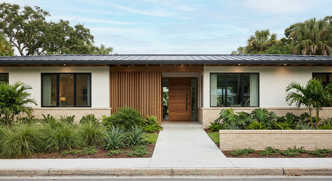
    The styles are uniform because the financing was. Minimal Traditional, Transitional Ranch and Mid-Century Modern all appear, each single-story, stucco over concrete masonry on a poured slab. The survey ties that uniformity to Federal Housing Administration lending caps, which pushed builders toward small, plain, efficient plans.

    “The proposed Croissant Park historic district appears eligible for listing on the National Register of Historic Places under Criterion A in the area of community development as an intact example of early suburban development in Fort Lauderdale.” — City of Fort Lauderdale, Intensive Level Architectural Resource Survey, Croissant Park and Poinciana Park

    Which streets could become historic districts?

    The survey named five candidates inside the neighborhood, all of them potential: four historic districts and one Multiple Property Submission. Their periods of significance do not line up, and that mismatch is the useful part.

    CandidateTypePeriod of significance
    Madrid StreetHistoric district1925 to 1939
    Reed-Marion-ByronMultiple Property Submission1925 to 1939
    PinehurstHistoric district1946 to 1958
    West River Croissant ParkHistoric district1946 to 1958
    Croissant Park SouthHistoric district1948 to 1953

    Across the wider study area the survey documented 24 individual resources, alongside 3 already designated as local landmarks and listed on the National Register.

    Broward County keeps its own historic sites inventory, drawn from National Register and Florida Division of Historical Resources data. It records two nearby anchors on South Andrews Avenue: the Administration Building at 1421, and the Frank Croissant House at 1313.

    What does the flood map say about Croissant Park?

    There is no single answer, which is the point. Sampling FEMA’s National Flood Hazard Layer across these streets yields three designations within about a mile. Zones AE and AH are Special Flood Hazard Areas, or SFHA; Zone X here is the lighter 0.2 percent annual-chance shading, which falls outside them.

    Sample pointFEMA zoneSFHA?Base flood elevation
    Croissant Park, 245 W. Park DrAEYes7 ft
    SW 3rd Ave, near SW 18th StAHYes7 ft
    SW 12th Ct, West River areaAE (coastal floodplain)Yes6 ft
    SW 4th Ave, near SW 15th StX (0.2% annual chance)NoNot assigned
    S Andrews Ave at 1421X (0.2% annual chance)NoNot assigned

    Source: FEMA National Flood Hazard Layer, queried July 2026. The effective Broward County FIRM panel covering the park, 12011C0557J, took effect July 31, 2024. Zone and elevation are property-specific; confirm any individual address against the official map.

    Two houses a few blocks apart can carry different designations and elevations a foot apart. What that means for your premium belongs with your carrier and lender, not a blog post. For a search the lesson is simpler: check each address early, before you fall for a floor plan.

    What does the park itself offer?

    The park itself is a 16.3-acre city facility at 245 W. Park Dr, open 6 a.m. to 9 p.m. and reachable at (954) 828-6154. The city’s parks listing records four amenities: lighted athletic fields, a pool, a recreation center and a water playground.

    It also shaped the district around it. In the original 1925 plat, the South section was bounded by West Park Boulevard, Park Lane and Byron Street. The survey notes that the land just north of it now holds a public school and this park.

    What should you check before you tour?

    1. Pull the FEMA zone for the exact address, never the neighborhood. Here the answer moves between AE, AH and X.
    2. Ask whether the home sits inside one of the 5 candidates above, and what would follow if designation advances.
    3. Date the structure against the survey window for its district.
    4. Look for the original pattern under the renovation. One story, stucco over concrete block, slab foundation, wide eaves, often a carport rather than a garage.

    Thomas Echea, who owns homes in Blue Ridge and Fort Lauderdale, works the second-home side of this market and reads the city survey before the listing sheet. Buyers arriving from downtown are usually swapping a view for a yard. That trade is easier to judge with the records open.

    Related reading: Riverwalk living in downtown Fort Lauderdale and choosing a condo or townhome in downtown Fort Lauderdale. Current Fort Lauderdale listings are updated as they come to market.

    Frequently asked questions

    Is Croissant Park in a flood zone?

    Partly. FEMA’s National Flood Hazard Layer returns Zone AE and Zone AH near the park. Both are Special Flood Hazard Areas. Other sample points return Zone X, the 0.2 percent annual chance shading, which falls outside them. Base flood elevations at the sampled AE and AH points were 6 and 7 feet. Zone is assigned per property, so confirm the specific address on FEMA’s official map, as of July 2026.

    How old are the homes in Croissant Park?

    It varies by block. The City of Fort Lauderdale’s five candidates carry periods of significance spanning 1925 to 1958. Madrid Street and Reed-Marion-Byron are the earliest, at 1925 to 1939; the other three fall between 1946 and 1958. The land was replatted under the Croissant name in 1925, and the survey records little building between 1926 and the end of the Second World War.

    Why is it called Croissant Park?

    It is named for G. Frank Croissant. In 1925, 570 acres of the former Placidena development were purchased and replatted by Gilbert F. Woods, Thomas E. Hoskins and Joseph P. Young. They renamed it for Croissant, the general manager of their Chicago land development firm, whom they chose to lead the project.

  • Riverwalk Living In Downtown Fort Lauderdale

    Riverwalk Living In Downtown Fort Lauderdale

    Riverwalk Fort Lauderdale is a 2.5-mile waterfront promenade of brick walkways and gardens running along both banks of the New River, and it anchors a roughly 3-square-mile downtown district. Living here means trading a beach-first routine for a river-and-city one. You can walk to dinner, a museum, a show, and a shaded park bench in a single evening, all before your car leaves the garage.

    Riverwalk Fort Lauderdale: Key Takeaways

    • The Riverwalk Linear Park runs 2.5 miles along the New River, inside a 3-square-mile district with 10-plus parks.
    • Daily life is walkable and water-facing: parks, dining, arts, and a free downtown trolley instead of a car.
    • Housing in 33301 is mostly condos and apartments, not single-family homes.
    • Boating is built in, with a city docking basin off Las Olas in the downtown core.
    • It suits buyers who want the water without giving up an urban, designer downtown.

    What Is Riverwalk Fort Lauderdale?

    Riverwalk Fort Lauderdale is two things at once. The core is the Riverwalk Linear Park, a 2.5-mile stretch of brick paths and gardens along the New River’s north and south banks, running from the Broward Center for the Performing Arts to Las Olas Boulevard. Around it sits the broader Riverwalk District, a 3-square-mile downtown area that ties together parks, culture, dining, and boating.

    The distinction matters when you are home shopping. The nonprofit Riverwalk Fort Lauderdale was established in December 1988 to steward this corridor, and it has done so for more than 30 years. Think of the address less as a single park and more as a walkable waterfront neighborhood.

    How Does Riverwalk Living Feel Day to Day?

    Downtown Fort Lauderdale skyline rising along the New River near Riverwalk
    Downtown Fort Lauderdale rises along the New River. Photo: Rstepp, public domain via Wikimedia Commons.

    Day to day, Riverwalk feels like a small city you can read on foot. Mornings start on the promenade with coffee and the river. Evenings drift toward Las Olas, a gallery, or a riverfront table. The rhythm is set by water and walkability, not by the drive to the sand.

    It is the downtown-meets-water balance Thomas Echea points to when buyers ask how the New River corridor differs from the beach. You stay close to the water while the everyday texture stays urban: shops, sidewalks, and short walks to nearly everything.

    Riverwalk Fort Lauderdale at a Glance

    FeatureDetail (as of June 2026)
    Linear park length2.5 miles of brick walkways, both banks of the New River
    Riverwalk District sizeRoughly 3 square miles downtown
    Parks in the district10-plus, including Esplanade and Huizenga
    Steward establishedRiverwalk Fort Lauderdale nonprofit, December 1988
    Primary ZIP code33301
    Housing mix (33301)About 78% in multi-unit buildings; about 63% renter-occupied
    Downtown boatingCity docking basin off Las Olas, about 100 slips

    What Parks and Public Spaces Line the New River?

    The district holds 10-plus parks, which is what keeps a dense downtown feeling livable. Riverwalk Linear Park supplies the spine: a waterfront walkway, benches, shade, and a gazebo along the river.

    Nearby, Esplanade Park adds seating, a pavilion, and event space. Huizenga Park reopened with an event lawn, a shaded dog run, riverfront seating, and public art. Together they give residents green space within a short walk in almost any direction.

    How Do You Get Around Downtown Without a Car?

    You lean on the free LauderGO! service. The city runs a free Water Trolley daily, with stops including Riverwalk, Esplanade Park, Tarpon River, and the New River Yacht Club. It turns the river itself into a commute.

    On land, the free LauderGO! Micro Mover circulates through downtown, Las Olas, and the beach, and it links to Brightline, groceries, and the library. The effect is a real transportation network, not just a visitor loop, so short car trips become optional.

    What Arts and Dining Anchor the District?

    Culture sits at the center, not the edge. The Broward Center for the Performing Arts fronts the New River and hosts Broadway tours, concerts, ballet, and opera. The NSU Art Museum sits at One East Las Olas Boulevard, and the Museum of Discovery and Science anchors the western downtown.

    Las Olas Boulevard supplies the dining and design spine, a tree-lined run of restaurants, boutiques, and galleries. The Historic Stranahan House and the Broward County Main Library round out a district that works full-time, not just at night.

    What Does Boating Access Look Like Here?

    For many buyers, boating is the reason Riverwalk outranks a standard downtown. Fort Lauderdale calls itself the Venice of America, with roughly 165 miles of inland waterways, and the New River runs straight through the core.

    The city operates a downtown docking basin off Las Olas with about 100 slips, full utilities, and a short walk to shops and cafes. That pairing of slips and sidewalks is rare. You get the water and the urban services in one address.

    What Housing Should You Expect in 33301?

    Expect condos and apartments. ZIP code 33301 is primarily a multifamily market: about 78% of units sit in multi-unit buildings and about 63% are renter-occupied, per recent American Community Survey estimates. Detached single-family homes are the exception here, not the rule.

    In practice, Riverwalk living usually means a mid-rise or high-rise with shared amenities and structured parking. If you are weighing formats, our guide to choosing a condo or townhome in downtown Fort Lauderdale walks through the tradeoffs.

    Is Riverwalk Fort Lauderdale Right for You?

    Riverwalk fits if you want to live at the center of the action while keeping the water in view. It suits buyers who value mixing leisure, culture, and convenience into one walkable neighborhood. You may especially like it if you want:

    • A condo or apartment lifestyle in 33301
    • Walkable access to parks, dining, and arts venues
    • A free downtown trolley that trims short car trips
    • A waterfront setting with real boating access
    • An urban, designer feel rather than a beach-centric one

    If a quieter downtown pocket appeals more, compare it with Croissant Park’s quiet streets and urban access. The right building, block, and view change everything here.

    Riverwalk is where Fort Lauderdale stops choosing between the water and the city. You get both in the same evening.

    Thomas Echea

    If you are exploring downtown and want a property-specific read on Riverwalk living, the E+E Group can help you compare buildings with clear eyes.

    Frequently Asked Questions About Riverwalk Fort Lauderdale

    What is Riverwalk in downtown Fort Lauderdale?

    Riverwalk is the waterfront core of downtown along the New River. It centers on a 2.5-mile linear park of brick walkways and gardens, set inside a roughly 3-square-mile district that links parks, cultural venues, dining, and boating.

    What type of homes are common near Riverwalk in 33301?

    Housing in 33301 is mostly multifamily. About 78% of units sit in multi-unit buildings, so buyers usually find condos and apartments rather than detached single-family homes.

    How is Riverwalk living different from beach living in Fort Lauderdale?

    Riverwalk living centers on an urban waterfront: parks, boating, downtown transit, dining, and arts venues along the New River. Beach living is organized around the ocean and the sand, with a more coastal, resort-style daily rhythm.

    What transit options serve the Riverwalk area?

    The area is served by the free LauderGO! Water Trolley and the free LauderGO! Micro Mover. Together they connect downtown destinations, Las Olas, the beach, Brightline, groceries, and the library.

    Is Riverwalk Fort Lauderdale good for boating access?

    Yes. The city operates a downtown docking basin off Las Olas with about 100 slips, full utilities, and walkable access to shops and restaurants, with direct New River access from the heart of downtown.

    Sources: Riverwalk (Fort Lauderdale), Wikipedia; Riverwalk Fort Lauderdale (About); City of Fort Lauderdale Parks & Rec; Census Reporter, ZIP 33301. Housing figures from American Community Survey estimates, as of June 2026.

  • Where To Buy In The Blue Ridge Surrounding Areas

    Where To Buy In The Blue Ridge Surrounding Areas

    Blue Ridge GA real estate is easiest to read by sub-area, not by one ZIP code. Within about 16 miles of the downtown depot you can choose a walkable rail town, a 3,290-acre lake, a 17-mile trail system, or a quiet ridge with no foot traffic at all. This guide compares the main buying zones around Blue Ridge and Fannin County so you can match the setting to how you actually plan to live, as of summer 2026.

    The quick read

    • Want walkability and guest appeal: downtown Blue Ridge.
    • Want water: Lake Blue Ridge and Morganton, about 6 miles west.
    • Want trails and a cabin feel: the Aska and Toccoa River corridor.
    • Want a river-town identity: McCaysville, on the Georgia-Tennessee line.
    • Want acreage and privacy: Mineral Bluff, Cherry Log, and Epworth.
    • Want orchards and a wider valley: Ellijay, about 16 miles southwest.

    Still getting a feel for the area? Our guide to the Blue Ridge area covers the towns, the drives, and the lifestyle behind the market.

    How is Blue Ridge GA real estate organized by area?

    Around Blue Ridge, setting and access shape value more than any single neighborhood pattern. Fannin County wraps a tight downtown, a TVA lake, a national-forest trail network, a state-line river town, and a ring of quiet rural communities, all within a short drive. Two homes with the same bedroom count can deliver very different days, so most buyers choose the corridor first and the house second. The table below maps each zone to its character, its rough distance from town, and what it is known for.

    Sub-areaVibeTo downtown Blue RidgeKnown for
    Downtown Blue RidgeWalkable rail townThe hubHistoric depot, galleries, scenic railway
    Aska / Toccoa corridorTrails and riverAbout 6 miles, ~15-min drive17-mile trail system, Toccoa float
    Lake Blue Ridge / MorgantonWater accessAbout 6 miles west3,290-acre lake, Morganton Point
    McCaysvilleRiver town on the lineAbout 13 miles northBlue Line, Toccoa-to-Ocoee
    Mineral BluffQuiet acreageAbout 6 miles northeastHistoric depot, privacy
    Cherry LogCabins, slow paceRoughly midway to EllijaySmall community, ~120 residents
    EpworthOpen rural viewsNorth on GA-5Cohutta views, ~1,700-ft elevation
    EllijayOrchard valleyAbout 16 miles southwestApple Capital of Georgia

    Is downtown Blue Ridge the easiest place to buy?

    For the simplest full-time or weekend setup, downtown Blue Ridge usually leads the list. The walkable core packs galleries, community theater, breweries, live music, a city park, and the historic depot into a few blocks. The Blue Ridge Scenic Railway departs from that depot and runs a roughly 26-mile round trip along the Toccoa River to McCaysville, which keeps the in-town blocks busy through the season.

    This pocket suits smaller in-town homes and renovated cottages more than large acreage. You buy access to town life first, then the house style that fits it. If your priority is seclusion or sweeping views, look past the rail-town core. For a closer read on the in-town option, see our guide to owning a cabin near downtown Blue Ridge.

    Where do you go for trails and river access?

    Toccoa River winding through forest in Fannin County near Blue Ridge, Georgia
    The Toccoa River in Fannin County, the spine of the Aska corridor. Photo: Wikimedia Commons (CC0).

    If trails and water are the point, the Aska Adventure Area earns a close look. Its trail system covers 17 miles of national-forest singletrack near Deep Gap, climbing to near 3,200 feet before dropping toward the Lake Blue Ridge shoreline, roughly a 15-minute drive from the Welcome Center. Details sit with the U.S. Forest Service.

    On the water, the Toccoa River Canoe Trail runs a 13.8-mile float through the same corridor, and the Swinging Bridge, a 270-foot span billed as the longest of its kind east of the Mississippi, carries hikers over the river. Homes here lean toward the classic cabin feel, with trail or river frontage doing the marketing. The deeper version lives in our Blue Ridge cabin market guide.

    Which area is best for lake access?

    When being on the water drives the purchase, Lake Blue Ridge and Morganton stand out. The lake spans 3,290 acres, stretches about 11 miles, and carries 65 miles of shoreline, with roughly 80 percent of that edge held inside the Chattahoochee National Forest, per the Fannin County Chamber. That forest ownership keeps the shoreline green and limits dense development.

    Morganton sits about 6 miles west of Blue Ridge on the northeast side of the lake. Morganton Point, the only developed campground on the shoreline, adds a swim beach, a boat ramp, and picnic areas. This zone fits a second home built around boating, paddling, and a destination feel for family and guests.

    What makes McCaysville different?

    McCaysville trades acreage for a memorable river-town identity. The town shares a main street with Copperhill, Tennessee, where a painted Blue Line marks the state border and lets you stand in two states at once. The Toccoa River becomes the Ocoee as it crosses north, and McCaysville anchors the northern end of the scenic railway, about 13 miles up the line from Blue Ridge. Riverfront dining and outfitters give the blocks a distinct draw for guests.

    Where should you buy for privacy and acreage?

    If space, views, and a quiet drive home rank first, the outer ring delivers. Mineral Bluff, a small railroad crossroads with a surviving historic depot, sits about 6 miles northeast and trades the four-minute walk to dinner for land and stillness. Acreage is the language here, not foot traffic.

    Cherry Log, a community of roughly 120 residents, falls midway between Blue Ridge and Ellijay, all cabins and slow pace. Epworth opens to rural views toward the Cohutta Mountains from near 1,700 feet of elevation, north of town on GA-5. Ellijay, the Apple Capital of Georgia, lies about 16 miles southwest with orchards and a wider valley. Explore Georgia is a useful neutral source as you weigh each one.

    How do you match an area to how you will live?

    Start with the use case, then the corridor. A few questions narrow the field fast:

    • Do you want town access, lake access, trail access, or privacy first?
    • Will the home work full-time, on weekends, or mainly as an investment?
    • How much drive time and back-road texture suits you?
    • Cottage, cabin, lake home, acreage, or land to build on?

    Full-time living leans toward downtown Blue Ridge, Morganton, and the better-accessed parts of Mineral Bluff. Weekend retreats favor Aska, Lake Blue Ridge, and Cherry Log. Rental appeal clusters where a clear anchor exists: downtown, McCaysville, Morganton Point, and the Toccoa corridor. Privacy and views run deepest in Mineral Bluff, Epworth, and the rural ridges. In the buyers Thomas Echea guides this side of the ridge, the right pocket almost always matters more than the floor plan. For the area at a glance, see the Blue Ridge neighborhood page.

    Frequently asked questions

    What is the closest area to downtown Blue Ridge?

    The Aska corridor, Lake Blue Ridge, Morganton, and Mineral Bluff all sit roughly 6 miles from the downtown depot, about a 15-minute drive. Downtown itself remains the hub for walkability and guest appeal.

    Which Blue Ridge area is best for lake access?

    Lake Blue Ridge and Morganton offer the strongest water access. The 3,290-acre lake carries 65 miles of mostly forest-lined shoreline, and Morganton Point adds the only developed campground, a swim beach, and a boat ramp.

    How far is Ellijay from Blue Ridge?

    Ellijay sits about 16 miles southwest of Blue Ridge, roughly a 20-minute drive. Known as the Apple Capital of Georgia, it offers orchards, a wider valley, and a larger county seat just outside Fannin County.

    Where should I buy for privacy near Blue Ridge?

    For acreage and quiet, look to Mineral Bluff, about 6 miles northeast, plus Cherry Log and Epworth. These outer communities trade walkability for land, views, and far less foot traffic than the rail-town core.

    If you want help comparing Blue Ridge, Morganton, Mineral Bluff, McCaysville, or the quieter pockets around Fannin County, reach out to Thomas Echea to sort the tradeoffs and find the fit with clear, local guidance.